

Introducing Iris 2.10
At T-Kartor, we are dedicated to continuously evolving our geospatial intelligence solutions. We are thrilled to announce the release of Iris 2.10, our most powerful and feature-rich update yet. This latest release introduces significant enhancements that empower users with more flexibility, efficiency, and security in managing their geospatial data.
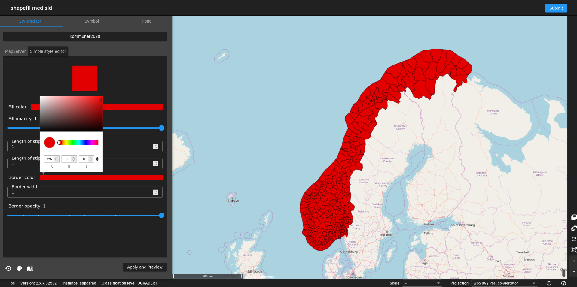
A More Intuitive Style Editor
Designing and managing map styles just got easier! With Iris 2.10, we introduce a new graphical style editor, building on the improvements made in version 2.9. Users can now create and modify raster and vector data styles through an intuitive UI, making geospatial visualization much more accessible. Additionally, SLD (Styled Layer Descriptor) support is now integrated, further expanding customization options.
WMC in WMC—More Complex Map Services
We understand the need for scalability and seamless integration. Previously, WMC datasets in Iris were limited and unable to be embedded within other WMC datasets. That changes with 2.10. Now, users can combine multiple complex products into a single dataset, streamlining map service creation and allowing for more comprehensive geospatial analyses.
Stronger Security with OAuth2 Integration
Security remains a top priority, and we are expanding authentication options. Iris 2.10 now supports OAuth2, providing an additional layer of access control while retaining previous security options, such as Active Directory integration; this means organizations can seamlessly align Iris with their existing security infrastructure.
Improved Crawling Capabilities for Large-Scale Data Management
Handling large amounts of data has never been smoother. With Iris 2.10, we introduce new configuration options for vector data ingestion using metadata files. Now, users can determine whether vector files in a folder should be:
- Combined into a single vector dataset
- Processed as individual vector datasets. This flexibility enhances the way large-scale geospatial datasets are structured and managed.
Enhanced Error Reporting for Faster Troubleshooting
We know that efficient issue resolution is key to maintaining seamless operations. The error reporting system in Iris now includes context-based information, capturing a snapshot of the user's view at the time of the issue; this makes it easier for administrators to diagnose and resolve problems quickly, minimizing downtime and maximizing productivity.
Next-Generation OpenStreetMap (OSM) Capabilities
For those utilizing offline, air-gapped OpenStreetMap databases, Iris 2.10 introduces a completely redesigned solution with significant enhancements:
- WMS/WMTS services for seamless map rendering
- Vector tile support for high-performance visualization
- Styling using MapLibre specifications, enabling rich, customized mapping
- Incremental updates via diff files, keeping data current without requiring full reprocessing
- Improved installation and maintenance workflows, making deployment more efficient
Introducing the Iris TileServer
Expanding the ecosystem of Iris, we are excited to introduce Iris TileServer—a powerful standalone component designed to generate vector tiles from PostgreSQL databases or MBTiles files. The TileServer utilizes the OGC API - Tiles standard, enhancing interoperability with existing clients. Key benefits include:
- High-performance tile generation and caching
- Seamless integration with existing geospatial workflows
- Optimized rendering for complex geospatial datasets
Pushing the Boundaries of Geospatial Intelligence
With Iris 2.10, we are taking a giant leap forward in making geospatial data management more flexible, secure, and scalable. Whether you're a government agency, defense organization, or enterprise managing critical geospatial assets, these enhancements will help you achieve greater efficiency, interoperability, and precision.
We look forward to seeing how our users leverage these powerful new features. Stay tuned for more updates as we continue to evolve Iris into the most advanced geospatial intelligence platform available.
Explore Iris 2.10 today and experience the next generation of geospatial intelligence.


