
Our Services
T-Kartor has a rich history of performing work alongside our esteemed clients. Our geospatial expertise spans a wide range of capabilities from cartographic map production, geospatial data production, wayfinding design and support, and custom application development.
Our team of experienced professionals are ready to support your mission needs.
Production Services
Rapid, High-Fidelity Map Production for Air, Sea, and Land
T-Kartor's Production Services deliver fast, flexible, and cost-effective feature production and cartographic mapping at scale for aviation, marine, and topographic applications. Combining open-source and commercial tools within a seamless production environment, our custom technology solution creates a precise, high-quality products that meet the most demanding operational and design standards.
Ready to take it to the next level? With a maintained geospatial data store and automated production rules, we can produce paper or digital maps on demand or at scale, ensuring consistency, accuracy, and speed for every output.
Multi-Domain Expertise
Proven data and map production experience in the aviation, marine, and land domains. Our trained Imagery Analysis can produce data at speed and scale.
Rapid, Automated Production
Streamlined workflows generate accurate maps quickly, from single outputs to longer-scale series.
Open & Commercial Tools
Flexible integration with both open-source and commercial technologies to fit diverse requirements.
Tailored Mapping Experiences
Apply our world-class wayfinding expertise to develop branded maps, totems, and signage that help people navigate with confidence.
Digital & Print Ready
Seamless production for both digital delivery and high-quality printed products.
Tailored Mapping Experiences
Apply our world-class wayfinding expertise to develop branded maps, totems, and signage that help people navigate with confidence.
Digital & Print Ready
Seamless production for both digital delivery and high-quality printed products.
Case Studies

Aeronautical Safety of Navigation
Overview
Since 2009, T-Kartor has supported the NGA's mission to deliver high-quality datasets for aeronautical safety of navigation, enhancing production efficiency and reducing costs.
Context
In 2018, T-Kartor was awarded a contract to manage the NGA's worldwide airfield and vertical obstruction data, which is critical for global aeronautical safety.
Scope
T-Kartor's current contract involves collecting and managing global aeronautical data, utilizing advanced tools such as the Odin ESRI Add-in to streamline production and maintain high-quality outputs.
Deliverables
T-Kartor has delivered over 5,200 airfields and more than 8.1 million vertical obstructions worldwide, ensuring the highest standards of aeronautical safety and navigation.
Aeronautical Chart Production
Overview
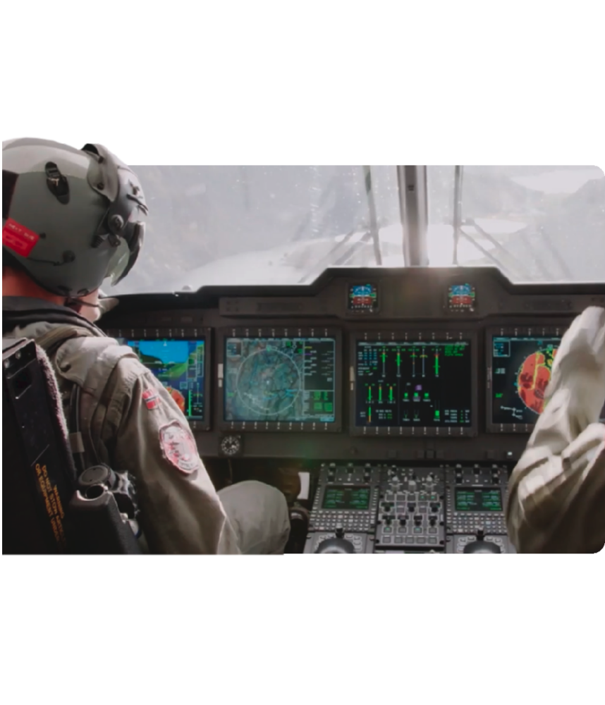
T-Kartor has been the trusted partner for classified aeronautical chart production for the Royal Norwegian Air Force since 2004, delivering thousands of products annually.
Context
The Royal Norwegian Air Force requires continuous, accurate updates to aeronautical charts, including vertical obstacle analyses and the creation of NOTAMs.
Scope
T-Kartor is responsible for maintaining a seamless geospatial database covering over 6 million sq km, delivering various aeronautical products every AIRAC cycle in compliance with strict regulations.
Deliverables
T-Kartor delivers over 10,000 aeronautical products annually, including various chart types and digital rasters, ensuring the Royal Norwegian Air Force has reliable, up-to-date information for all operations.
Case Studies

Aeronautical Safety of Navigation
Overview
Since 2009, T-Kartor has supported the NGA's mission to deliver high-quality datasets for aeronautical safety of navigation, enhancing production efficiency and reducing costs.
Context
In 2018, T-Kartor was awarded a contract to manage the NGA's worldwide airfield and vertical obstruction data, which is critical for global aeronautical safety.
Scope
T-Kartor's current contract involves collecting and managing global aeronautical data, utilizing advanced tools such as the Odin ESRI Add-in to streamline production and maintain high-quality outputs.
Deliverables
T-Kartor has delivered over 5,200 airfields and more than 8.1 million vertical obstructions worldwide, ensuring the highest standards of aeronautical safety and navigation.

Aeronautical Chart Production
Overview
T-Kartor has been the trusted partner for classified aeronautical chart production for the Royal Norwegian Air Force since 2004, delivering thousands of products annually.
Context
The Royal Norwegian Air Force requires continuous, accurate updates to aeronautical charts, including vertical obstacle analyses and the creation of NOTAMs.
Scope
T-Kartor is responsible for maintaining a seamless geospatial database covering over 6 million sq km, delivering various aeronautical products every AIRAC cycle in compliance with strict regulations.
Deliverables
T-Kartor delivers over 10,000 aeronautical products annually, including various chart types and digital rasters, ensuring the Royal Norwegian Air Force has reliable, up-to-date information for all operations.
Whole-Systems Wayfinding Services
Connecting People to Places and Spaces Through Intelligent Mapping and Design
T-Kartor's Whole-System Wayfinding service transforms how people connect, navigate, explore, and experience cities, campuses, parks, and transit environments. By uniting people, businesses, information, digital tools, and physical signage into a single, coherent system, we help communities create wayfinding networks that are current, consistent, and human-centered.
From initial stakeholder's engagement to final implementation, our team works across every layer of the wayfinding journey, ensuring information is accurate, beautifully designed, and accessible wherever people need it.
Stakeholder Collaboration
Brings together city officials, transit agencies, cultural institutions, community leaders, and more to build shared ownership.
Community Insights at the Core
Uses precise mapping and data to keep information synchronized, scalable, and easy to update.
Tailored to Each Environment
Custom solutions for urban spaces, campuses, parks, transit systems, cultural destinations, and events.
Holistic Design Approach
Integrates print, digital, and mobile wayfinding into one clear language for a seamless user experience.
End-to-End Delivery
From strategy, mapping, and design to production and installation, we deliver fully realized wayfinding systems.
Brand + Function
Aligns navigation with local identity, creating systems that both orient and inspire.
Case Studies

Legible London
Overview
T-Kartor played a key role in developing and maintaining the Legible London (LL) wayfinding system, designed to enhance pedestrian navigation and improve the balance between vehicles, pedestrians, and cyclists across the city.
Context
As part of London's transport policy, TfL introduced LL to promote walking and boost confidence in navigating the city. Pilots showed that LL reduced pedestrian journey times by 16%, with 91% of users supporting its installation city-wide.
Scope
T-Kartor rolled out 1,600 maps at 400 cycle docking stations for the launch of London's Cycle Hire system in 2010. For the 2012 Olympics, T-Kartor expanded the LL basemap to cover Greater London, creating specialized maps for tourists and athletes alike. The LL database is regularly updated and maintained with feedback from TfL and local stakeholders.
Deliverables
- Pedestrian wayfinding monoliths
- Cycle Hire docking station maps
- Olympic walking and cycling route maps
- Citywide visitor guides
- Bus vicinity and diversion maps

WalkNYC
Overview
T-Kartor partnered with the New York City DOT to develop the WalkNYC wayfinding system, improving pedestrian navigation and transit use across all five boroughs through a consistent and inclusive design.
Context
The NYC DOT identified a need for improved pedestrian information, as many people struggled with navigation after exiting the subways. WalkNYC was designed to address this issue with clear, accessible signage throughout the city, utilizing a familiar visual language inspired by the subway system.
Scope
T-Kartor created a versatile basemap that integrates data for pedestrians, cyclists, and transit users. This basemap is used for on-street signage, bikeshare docking stations, subway maps, and community initiatives promoting public space engagement.
Deliverables
- 600 wayfinding signs
- 360 bikeshare docking station maps
- 470 subway station maps
- Folded maps for community initiatives
Testimonial
''T-Kartor's professionalism and quality work exceeded our expectations.'' — Wendy Feuer, Assistant Commissioner, NYC DOT
Whole-Systems Wayfinding Services
Connecting People to Places and Spaces Through Intelligent Mapping and Design
T-Kartor's Whole-System Wayfinding service transforms how people connect, navigate, explore, and experience cities, campuses, parks, and transit environments. By uniting people, businesses, information, digital tools, and physical signage into a single, coherent system, we help communities create wayfinding networks that are current, consistent, and human-centered.
From initial stakeholder's engagement to final implementation, our team works across every layer of the wayfinding journey, ensuring information is accurate, beautifully designed, and accessible wherever people need it.
Stakeholder Collaboration
Brings together city officials, transit agencies, cultural institutions, community leaders, and more to build shared ownership.
Community Insights at the Core
Uses precise mapping and data to keep information synchronized, scalable, and easy to update.
Tailored to Each Environment
Custom solutions for urban spaces, campuses, parks, transit systems, cultural destinations, and events.
Holistic Design Approach
Integrates print, digital, and mobile wayfinding into one clear language for a seamless user experience.
End-to-End Delivery
From strategy, mapping, and design to production and installation, we deliver fully realized wayfinding systems.
Brand + Function
Aligns navigation with local identity, creating systems that both orient and inspire.
Case Studies

Transport for London
Overview
T-Kartor played a key role in developing and maintaining the Legible London (LL) wayfinding system, designed to enhance pedestrian navigation and improve the balance between vehicles, pedestrians, and cyclists across the city.
Context
As part of London's transport policy, TfL introduced LL to promote walking and boost confidence in navigating the city. Pilots showed that LL reduced pedestrian journey times by 16%, with 91% of users supporting its installation city-wide.
Scope
T-Kartor rolled out 1,600 maps at 400 cycle docking stations for the launch of London's Cycle Hire system in 2010. For the 2012 Olympics, T-Kartor expanded the LL basemap to cover Greater London, creating specialized maps for tourists and athletes alike. The LL database is regularly updated and maintained with feedback from TfL and local stakeholders.
Deliverables
- Pedestrian wayfinding monoliths
- Cycle Hire docking station maps
- Olympic walking and cycling route maps
- Citywide visitor guides
- Bus vicinity and diversion maps

DOT WalkNYC
Overview
T-Kartor partnered with the New York City DOT to develop the WalkNYC wayfinding system, improving pedestrian navigation and transit use across all five boroughs through a consistent and inclusive design.
Context
The NYC DOT identified a need for improved pedestrian information, as many people struggled with navigation after exiting the subways. WalkNYC was designed to address this issue with clear, accessible signage throughout the city, utilizing a familiar visual language inspired by the subway system.
Scope
T-Kartor created a versatile basemap that integrates data for pedestrians, cyclists, and transit users. This basemap is used for on-street signage, bikeshare docking stations, subway maps, and community initiatives promoting public space engagement.
Deliverables
- 600 wayfinding signs
- 360 bikeshare docking station maps
- 470 subway station maps
- Folded maps for community initiatives
Testimonial
''T-Kartor's professionalism and quality work exceeded our expectations.'' — Wendy Feuer, Assistant Commissioner, NYC DOT
Custom Application Development
Custom Solutions for Integration and Streamlined Workflows
Our custom application development services help you turn complex challenges into powerful, user-friendly solutions. We design and build tailored web and mobile applications that integrate seamlessly with your existing systems, streamline workflows, and deliver measurable business results. From concept to deployment, our team ensures every solution is scalable, secure, and built to evolve with your organization's needs.
With over 40 years of experience delivering geospatial solutions, T-Kartor's engineering team is ready to help build the custom application you need.
Streamline Workflows
Use custom applications to encapsulate complex workflows and tasks into a simple, streamlined user experience. No more hunting for the right tools, everything is right where it should be
Reduce Errors
Supporting users in the field? Give them a tailored experience with just the information and tools they need, reducing time to action, and minimizing potential errors at the same time.
Deploy Resources Fast
Our team of engineers has the development experience needed to get you up-and-running quickly. No ramp-up time needed. Simply provide your requirements and let our team handle the work.
Request a Demo
Schedule a meeting with our experts to discover how our spatial solutions can benefit your organization.
Contact Us
We will get back to you as soon as possible.
Please try again later.
Custom Application Development
Custom Solutions for Integration and Streamlined Workflows
Our custom application development services help you turn complex challenges into powerful, user-friendly solutions. We design and build tailored web and mobile applications that integrate seamlessly with your existing systems, streamline workflows, and deliver measurable business results. From concept to deployment, our team ensures every solution is scalable, secure, and built to evolve with your organization's needs.
With over 40 years of experience delivering geospatial solutions, T-Kartor's engineering team is ready to help build the custom application you need.
Streamline Workflows
Use custom applications to encapsulate complex workflows and tasks into a simple, streamlined user experience. No more hunting for the right tools, everything is right where it should be
Reduce Errors
Supporting users in the field? Give them a tailored experience with just the information and tools they need, reducing time to action, and minimizing potential errors at the same time.
Deploy Resources Fast
Our team of engineers has the development experience needed to get you up-and-running quickly. No ramp-up time needed. Simply provide your requirements and let our team handle the work.


